 |
 |
|||
|
 Roads
& Canals Roads
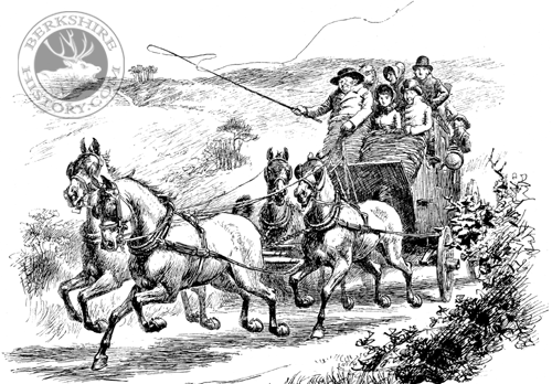
& Canalsthrough Reading Getting About in the Olden Days Compared with the stirring times of Roundhead and Cavalier, the 18th century in Reading seems dull indeed. The Abbey was now degraded into a quarry for building materials. The cloth trade had long been dwindling. No searching questions in religion or politics stirred the nation. Nevertheless, much quiet progress in Reading was going on, and in no direction was more useful progress made than in respect of roads and waterways. In the reign of Queen Anne (1702-1714) the approaches by road to Reading were very bad. No-one had troubled to mend them for a long time and, often, they were almost impassable. Sometimes a carriage would stick fast in the mire until additional horses were brought to drag it forward. In 1714, therefore, the members of Parliament for Reading managed to secure an Act of Parliament whereby the great western road from Reading to a point beyond Theale was put in good order. Four years later, another Act made it possible to repair and keep in order that part of the London Road which lies between Reading and Maidenhead Bridge. About the same time Sir William Blackstone, MP for Wallingford, carried through a scheme by which a good road was made from Oxford to Wallingford and from Wallingford to Reading. Henceforth, therefore, the best route from Reading to Oxford was along the road now called the Oxford Road, and not, as in former times, over Caversham Bridge. In 1724, John Watts, Mayor of Reading, raised a public fund in order to improve the road between Reading and Caversham Bridge. Hitherto, every time the locks on the Thames to the westward of Reading were opened, the roadway and meadows between Caversham Bridge and Reading had been flooded. In Winter, this piece of road had often been impassable for weeks on end, and the Oxfordshire villagers could not get to Reading market. About the same date, Caversham Bridge was repaired. While Reading was thus improving its approaches, roads were also being improved elsewhere. The result was that, before the 18th century closed, Reading became linked with the chief towns of the kingdom by a splendid system of smooth roads on which mail-coaches could run at a rapid pace. During the same period, much was done to improve and extend the waterways of the country. The trade of England was growing fast, and it was necessary to find some cheap and easy way of carrying heavy goods from one part of the country to another. Even if the roads had been much better than they were, it would not have been possible to carry all such goods in waggons, except at very great expense. Therefore, men began to turn their minds to the rivers and to plan and make artificial waterways or canals. One of the earliest of these canals was that connecting Reading and Newbury. Reading and Newbury were already connected by the River Kennet, but the channel of the Kennet was not, in all parts, deep or straight enough for heavy barges. About 1723, therefore, parts of the Kennet channel between Reading and Newbury were joined together by a number of cuts or canals, and, in this manner, a waterway, eighteen and a half miles along, controlled by twenty locks and deep enough to carry barges of 110 tons burden, was constructed at a cost of £84,000. This was a great step, but between 1795 and 1810 this line of waterway was extended. The Kennet and Avon Canal was then made under the direction of the famous engineer John Rennie, at a cost of about a million pounds. Its effect was to connect Reading by means of an excellent waterway with Bristol. Further, between 1800 and 1802 an improvement was made in the Kennet channel between High Bridge in Duke Street and the Thames. The channel was made deeper and straighter. Thus Reading could be reached by water from Bristol on the west and from London on the east. During the same period, canals were made from Oxford to Birmingham, and from Lechlade, the point at which the Thames ceases to be navigable, to the Severn. These new waterways placed Reading in direct communication with the Midlands and South Wales. The trade of Reading gained much by these improvements. Reading is the chief town in a large district thickly covered with villages and farms. From the date of these improvements, it became an important centre of export and import trade. From the Kennet wharves, great quantities of flour, malt, timber, cheese and wool were despatched in barges to London and other markets. While, to the same wharves and by the same waterways, iron and hardware were brought from Birmingham, stone from Bath, coal from Somerset and Wales, pottery from Staffordshire and groceries from London. Along the roads also came more and more traffic. By day and by night, coaches rattled through the streets. Great inns, like the Crown, the George, the Bear and the King's Arms (on Castle Hill), sprang into note as coaching inns. The population, which during most of the 18th century had hardly grown at all, began, at the close, to grow fast. It is believed that, in 1700, the number of people in Reading was about 7,690. In 1801, when the first official census was held, the number was returned as 9,421. But within the next ten years (1801-1811), there occurred an increase almost as large as the total increase during the previous century. There is no doubt that the population of the town now began to grow fast because of the better roads and new waterways which had made Reading into an excellent centre for trade. Edited from W.M. Childs' "The Story of the Town of Reading" (1905)
|
|||
| © Nash Ford Publishing 2017. All Rights Reserved. | ||||


